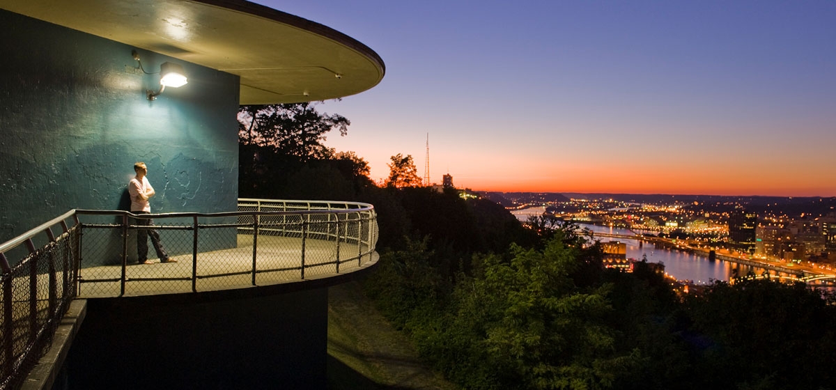
The first Native Americans to spot the first white men approaching their halcyon Green Triangle did so from the same basic observation deck—give or take a few hundred yards—where native ’Burghers admire their Golden Triangle today. By moonlight, those Indian sentries had a perfect view of all telltale torches and flickering campfires at the confluence of their three rivers down below.
[ngg src=”galleries” ids=”124″ display=”basic_thumbnail” thumbnail_crop=”0″]
Two hundred years later, I caught my own first spectacular nighttime sight of it from that same perfect vantage point, as a wee child curled up in the picture window of my godparents’ house on Mt. Washington, mesmerized by the lights below and the big Clark Bar sign that always flashed me to sleep.
Jimmy and Julia—my parents’ best friends and favorite bridge partners—belonged to a charming, prosperous local family. Their glorious Grandview Avenue digs were near St. Mary of the Mount, where my brother was baptized (and where Jimmy irregularly confessed his sins), just a few blocks from the “Paris V-Bar” (“V” for victory), which my father bought in 1942 before impetuously signing up for the Marines and leaving my poor mother to run the place—with a little help from Jimmy.
But enough autobiography.
Let us sing the Song of Mt. Washington—or what the Indians might have called Mt. Guyasuta, had military things worked out differently. It’s the place where more than a million people a year come for the most breathtaking views of Pittsburgh, just 10 minutes from Downtown—IF you make all the right moves.
Pity the hapless tourist who relies on a two-dimensional map instead of a native or sophisticated GPS to get there. On paper, P.J. McArdle Road (down below) and Grandview Avenue (up above) look deceptively parallel. You need the former to drive up to the latter. But in general, you need a 3-D model to grasp Mt. Washington’s bizarre topography and the insanely steep “goathills” that make it the world’s most terrifying place to drive a stick shift—as well as the most stunning urban vista in America.
During Pittsburgh’s colonial period, that rocky mass rising straight up from the south bank of the Monongahela River was known as Coal Hill. British settlers began mining it in the 1760s, with easy access to the coal seam’s outcrop near the base of the hill. By the early 19th century, several mines, as well as now-forgotten rock quarries, were in operation there. Gray sandstone quarried at Coal Hill, for example, was used to build the second Allegheny County Courthouse.
The Industrial Revolution soon gained steam—literally—and this region’s abundant raw materials, fuel supplies and convenient channels of river transportation made Pittsburgh the industrial hub of America. Manufacturing ventures multiplied and, with them, the need for labor. German, Irish and East European immigrants began to arrive en masse, lured by jobs in the burgeoning iron, coal, glass and steel industries.
Pittsburgh seemed to offer everything to everybody—except space. As the number of factories and workers rapidly expanded, most of the land near the rivers was occupied to capacity. Housing on the South Side flats was particularly scarce, and public transportation primitive. Instead of moving out, many hardy residents moved up, carving little homes on the slopes and, eventually, on the hilltop itself.
Ah, that hilltop… with its fantastic vistas of the Ohio and Allegheny River Valleys and downtown Pittsburgh. Working-class folks weren’t going there for the view, but by the 1876 Centennial, Coal Hill (and neighboring Duquesne Heights) was going by the grander name of Mt. Washington, and the most affluent of them were constructing grander residences along Grandview Avenue.
But the problem for rich and poor ’Burghers alike then—no less than tourists today—was: How do you get up there?
The ingenious answer was a mechanical device as ancient as the Greeks.
The circuitous dirt roads winding up Mt. Washington’s arduous slopes were so narrow they could barely accommodate a team of horses pulling a wagon. People living above and laboring in the mills below had a grim choice every day after work, when they were most exhausted: either walk the double distance of the roadways or climb the virtually vertical footpaths up to their houses each day.
The German immigrants among them, however, were longingly familiar with the steilbahns (literally, “steep rail/pathways”) back home in the Bavarian Alpine regions, and their petitions—when joined by commercial interests and developers—eventually resulted in the construction of more than a dozen “inclines” from the banks of the Mon and Ohio up the mountain, shuttling passengers and freight between the factories and rail stations on the rivers and the new neighborhoods spreading along the top of the bluff. Some of the funiculars even ferried horses up and down, too.
First to be built was the Monongahela Inclined Plane in 1870, at a cost of $50,000. It was—and still is—635 feet long, rising on a 35-degree grade to an elevation of 369 feet, at six miles per hour, with a car capacity of 23. The Mon Incline not only gave workers easy access to the stores and factories below but also opened up Mt. Washington and the areas behind it to a real-estate development boom. In 1982, this incline’s cars were replaced, its stations renovated, and its trestle converted to a new steel track structure on concrete piers. A decade later, the electrical and mechanical components of its machinery were upgraded and trackway lighting installed.
A mile or so away, at the other end of Mt. Washington, is the beautiful, majestic Duquesne Incline, built in 1877, with a 30-degree grade and an 800-foot elevation. It was close to going out of business when a group of residents raised money and took over its operation as a non-profit society in 1963. In subsequent years, the bright red original wooden cable cars—with their ornate interior carvings by German artisans—have been restored to perfection.
The Duquesne Incline’s top station on Grandview is a must for visitors, featuring excellent photographic displays of Pittsburgh history, as well as an outdoor observation deck. Fares for both ’planes are $2 each way ($2.50 roundtrip, with a transfer good for three hours) and $1 for kids under 12. Hours of operation are Monday through Saturday, 5:30 a.m. to 12:45 a.m.; Sunday and holidays 8:45 a.m. to midnight.
It’s little short of a miracle that both of these are among the precious few surviving, working inclines in America. Together they’ve carried millions of people from the 19th into the 21st centuries, and they still remain the best way for folks on the mount to get down—or “dahn,” as the natives say—to work or to the Station Square complex, with its array of boutiques and eateries, including the awesome Grand Concourse.
Conversely, for tourists, the inclines are also the most scenic and dramatic way to get up the hill as well as down.
So what’s to do at the top?
Eat ’n Park—in reverse order of difficulty—if you insist on driving a car. For a few visitors to the mount, the nightmare is acrophobia; for most, it’s parking. The simple solution is just to park at the bottom and take one of those gentle inclines heavenward. That way, upon arrival, you’ll be free to Eat ’n Gawk rather than Park ’n Walk much farther than you’d wish.
No matter how you get there, I’d suggest gawking before eating—at any or all of the four scenic overlook decks that jut out from the mount along Grandview Avenue, which traverses the length of the ledge overlooking Pittsburgh. Families, tourists and local sweethearts converge with bridal parties and prom revelers here, coexisting very politely, all snapping away or being snapped for presumptive posterity.
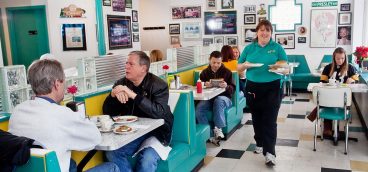
Having gawked, it’s time to eat. If you took the Duquesne Incline up, you’ll be happy to discover that it deposits you right smack in the center of Grandview Avenue’s “Restaurant Row,” where there’s nary a bad meal or bad view to be had. Among the best:
Bella Vista Restaurant (Italian)
1204 Grandview, 412-431-1660
Coal Hill Steak House
1212 Grandview, 412-431-1400
Georgetowne Inn (American)
1230 Grandview, 412-481-4424
Isabela (French, Euro, seafood)
1318 Grandview, 412-431-5882
Le Mont (American & French)
1114 Grandview, 412-431-3100
Monterey Bay Fish Grotto (seafood)
1411 Grandview, 412-481-4414
Tin Angel (American & Greek)
1200 Grandview, 412-381-1919
The last of those is where President Bill Clinton and British Prime Minister John Major ended up for a boys’-night-out repast after riding the Duquesne Incline on Feb. 28, 1994. Major’s father lived in Pittsburgh for a while in his youth. The P. M. enjoyed the Angel’s seafood, Iron City beer, and view of the city, while Bubba devoured the Black Forest filet (they evidently ran out of Whoppers that night).
As this major event did not take place during football season, President Clinton was spared the minor task of explaining at least one local idiosyncrasy: On Steeler game days, a lighted sign is added to the Duquesne Incline’s two cars—the left one reading “DEEE” and the right one “FENSE.” When the cars pass each other at the halfway point, they read “DEEEFENSE”—nowadays visible from Heinz Field.
It’s not all about Grandview—even though architecture lovers come from far and wide to rave about the fine examples of Queen-Anne-style residences lining that avenue. Among other noteworthy streets, the most commercially and residentially desirable bear Civil War names, such as Shiloh, Ulysses, Virginia and Merrimac.
Shiloh is by far the most “happenin’.” Its crown jewel establishment is the Shiloh Grille, with its piano bar and elegant ’Burgh-historical Soffel and Biddle rooms. Down the block are popular DiFiore’s Ice Cream, Grand Brew Cafe, Redbeard’s, Café Nico, Scarpaci’s Saloon and the Hot Rod Café, while La Tavola (on Boggs) and Satalio’s (on Bailey) are nearby favorites, as well.
Shiloh Street, in addition to bars and restaurants, has a welcome new addition these days in the form of “221 Flexed,” an art-and-music exhibit space in what was once a law firm at 221 Shiloh, now showcasing the creativity, entrepreneurship and artistic soul of the ’hood. Its proprietor, the Cityzens property-rentals company, has made a long-term commitment to Mt. Washington, while visionary artists, such as Jenna-Ann Sabom, see its potential as a gallery to rival the best in Lawrenceville or Downtown.
Precipitous, cobblestoned Wyoming and Sycamore streets—so ecstatically death-defying in “slippy” winter—remind us that the mount is not all about inclines, either. Pittsburgh’s residential growth largely followed the Pennsylvania Railroad through the fairly level suburbs—Shadyside, East Liberty and Wilkinsburg—to the east. To the south, Mt. Washington’s front-face escarpment posed a 400-foot-high hurdle. The only place its topography relents is at Sycamore (on the front), corresponding with “The Hollow” at Warrington Avenue (on the back side), where Jacob Beltzhoover opened his coal mining operations in 1825.
That takes us (as it took Jacob) from the ladder “up and over” approach to the “down and under” alternative: The first major tunnels bored through the solid rock beneath Mt. Washington were the Wabash and South Hills Trolley Tunnels of 1904, with town-side portals on Carson Street. (In the line’s most horrific accident, on Christmas Eve of 1917, a trolley car lost control coming down the six-degree grade, plunged through the tunnel and overturned on Carson, killing 21 people and injuring 80.)
Later paved, lighted and ventilated for busway use as well as light-rail traffic, the renamed Mt. Washington Transit Tunnel now carries Port Authority Allegheny County “T” vehicles from South Hills Junction to Carson & Smithfield. The sooty, much-loved-and-hated Liberty Tunnel (“Tubes”) under Mt. Washington opened in 1928 for cars, followed in 1960 by the then-sleek, state-of-the-art Fort Pitt Tunnel.
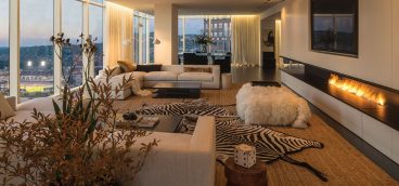
The state of that claustrophobic construction art hasn’t gotten much better, or sleeker, in the half-century since, but the quality of life on Mt. Washington has. Today, it offers what many consider a wider range of housing options and opportunities than any other Pittsburgh neighborhood, from elegant old Victorians, upscale condos and designer homes to humble apartments and duplexes, with lots of sensible middle-class dwellings in between.
It takes all kinds for the all-kinds mix of families, “empty nesters,” yuppie singles and couples, students and professionals, and assorted down-home descendants of blue-collar folks who’ve lived for generations in the nooks and crannies of these heights, not much caring if their rooms came with or without a view.
One of my personal favorite nooks is Chatham Village, a compact community of 200 Georgian-style red brick townhouses and gardens on the far south end of Mt. Washington. Built in the early 1930s, it’s a celebrated model of the Garden City Movement—community planning experiments looking to find a capitalistic solution to the mounting foreclosures and national housing crisis of the Depression.
The Buhl Foundation funded its limited-dividend investment approach as an alternative to “socialist” government subsidies, and the resulting village was—and remains—a gem. Pedestrian and auto traffic are separated. All homes face an inner courtyard. Recreational areas abound. Maintenance is meticulous. Initially, preferred tenants were expected to be “socially and financially stable white-collar people with good taste.” Now, as a 21st century co-op, it’s still pretty much the same—and still a brilliantly innovative example of residential site-planning and design.
In addition to their homes and commercial districts, Mt. Washingtonians have been protecting and improving their green spaces, as well. In 2005, the Grandview Scenic Byway Park was designated for 280 acres ringing the mount and adjacent neighborhoods, and two years later a $154,000 federal grant arrived to implement the master landscape plan. Prior to consolidation, those acres were a hodgepodge of mini-parks, scrub-forested hillsides, ballfields and derelict land parcels. Now, thanks to the Mt. Washington Community Development Corp., hiking and biking trails will connect the three parklets with the wooded areas to maximize the natural beauty and outdoor recreation offerings.
Pittsburghers are nothing if not resourceful, after all. Mayor Luke Ravenstahl says the city is considering putting windmills atop Mt. Washington to generate electricity with wind-driven turbines and thus cut energy costs. (He’s also a realist who acknowledges the challenging difficulties: “You know how tricky it is even to build a building on Mt. Washington, much less a windmill up there.”)
Symbolic of such new and old challenges is artist Jim West’s striking bronze statue in Grandview Park, depicting the historic meeting between George Washington and Seneca leader Guyasuta there in October 1770. They had first met in 1753, when Guyasuta led the young officer Washington up the Allegheny River to serve notice on the French that they should vacate the area for the British. That order was declined, leading to the long, bitter French and Indian War, in which Washington and Guyasuta were first allies, then enemies. West’s sculpture shows the old warriors in council 17 years later, discussing the past and future of the three rivers’ coveted fork. Tension as well as respect are evident between the two leaders, who had diametrically different goals for the area: Washington had surveyed it for further white European settlement; Guyasuta reminded him of the 1763 British treaty prohibiting just such expansion.
The perfect title of West’s work? It’s called “Point of View.” West says he hopes modern folks might visit it when they want to work out their differences—or just drink in the Point and the View, ranked the second most beautiful in America by USA Weekend Magazine: “In a nation with a wealth of stunning cities full of compelling stories, ranking Pittsburgh as the No. 2 beauty spot is perhaps our most surprising choice. But the Steel City’s aesthetic appeal is undeniable, as is its very American capacity for renewal.”
Indeed. What could the No. 1 choice have been? Who cares. All we know and care about is that dazzling panorama of hills and vales and skyscrapers nestled where the Allegheny and Mon form the mighty Ohio, while the lights twinkle up at us from the city and its bridges below.
The romance in your life seems to be waning? No need for Viagra when you have the view from Mt. Washington at night.


