The Laurel Highlands. The very name hints of a special place. Its boundaries lie in the eye of the beholder, but most agree that the Highlands are east and south of Pittsburgh in Somerset, Fayette and Westmoreland counties. Thousands of skiers, hunters, hikers and rafters enjoy this unique geography, but do they ever ponder how it came to be?
It’s hard to imagine, but the land once was flat and largely covered by a shallow, inland sea. Thick layers of sediment on the sea bottom slowly solidified over time to form what geologists call Pottsville sandstone. Then, about 480 million years ago—give or take a few million—forces deep in the earth triggered a collision of the massive tectonic plates that form the outer earth. The collision forced the plates’ leading edges up into mountains and ridges thousands of feet high. And that was the dramatic birth of what would become the daring ski trails, plunging rapids, steep rock cliffs and tranquil valleys of the Laurel Highlands.
The miles-long, narrow mountain strips we call Laurel and Chestnut ridges lie under a mantle of rich green in summer, blaze with color in fall, then turn quietly white with winter snow. It is a year-long show Pittsburghers love. It’s true, much of western Pennsylvania abounds in hills, valleys and rivers, but there are appealing differences in the 100-mile footprint of the Highlands.
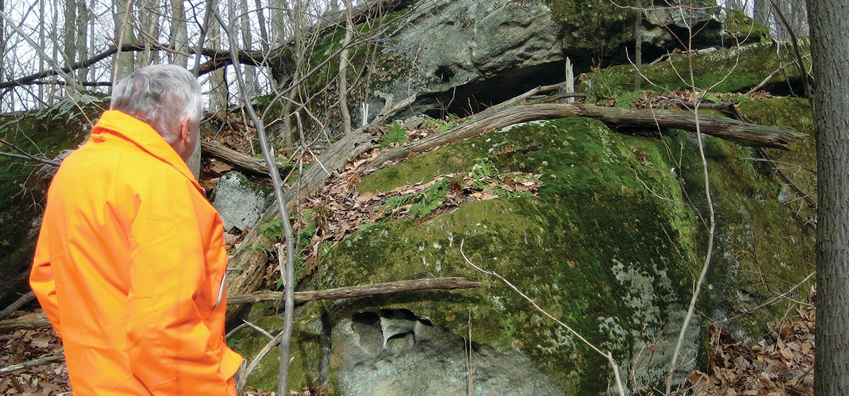
I fell in love with the area over 30 years ago when we acquired a modest cabin along Laurel Hill Creek. Traveling the Pennsylvania Turnpike to Donegal, I became fascinated with the places where the Turnpike cuts through the mountains. Like slicing into a giant layer cake, you can see how the various strata of thick rock that had stretched horizontally for miles suddenly bent sharply upward. I became puzzled by the giant boulders dotting the Highland hills. Some were the size of railroad cars! How did they get there? Over years of trout fishing and hunting in those hills, I marveled at this unusual land only a relatively few miles from Pittsburgh. I decided to seek some answers.
Paul Wiegman is a writer and naturalist who knows well the history of the Laurel Highlands. In a recent essay, he put it this way: “Here in Western Pennsylvania, we are blessed with the oldest mountains on the planet. The folds of these mountains were created when two great land masses, known as crustal plates, collided. The mountains then were jagged and craggy like the Rockies of the west. However, over an enormous stretch of time, the landscape was eroded and smoothed by wind and rain to the more gentle rolling ridges we know today.”
University of Pittsburgh geologist Thomas Anderson is both a student and teacher of how the Highlands came to be, and he described how water further shaped that creation. “The Youghiogheny River cut down through the underlying rocks the way an overhead saw cuts through a stack of boards. Where resistant layers were met, falls and rapids were formed.” The lower Yough is famous as a wild, wet roller coaster, and the whitewater enthusiasts drawn to it are riding geologic history. But in the distant future, Anderson said, the dramatic ride will disappear. “Eventually the river will cut through the sandstone layers forming the falls and rapids, and the river will become a smooth one throughout its length.”
And what of the enormous boulders on the hillsides? They were once part of the 100-foot-thick crust of Pottsville sandstone that millions of years ago broke apart as the colliding plates thrust it upwards. Over time, some of those giant pieces slid down the ridges, and the same freeze-thaw cycle that destroys our roads had its way with those boulders, cracking and splitting them into unusual shapes.
Slowly but surely, those boulders are creeping their way from the peaks down to the valleys, Wiegman said, “at the rate of only millimeters per year under the relentless pull of gravity.” So don’t worry, you still have a few hundred million years to enjoy the Laurel Highlands just as they are.


